Wednesday, May 31, 2006

HEADING WEST: MAY 31. 2006


To venture into the so-called western and eastern regions of the city, we layered all of the responses we had received from our two City Hall visits onto the Walk Oakland map. By doing this, we could see how far people's perceptions of the regions spanned and where their areas of overlap lay. Cool colors denote the 'boundaries' of the west and warm colors denote 'boundaries' of the east.

We are using City Hall as our launch site. Even as we pull up and begin to select our route with the map and GPS, curious passers-by want to know what we is going on. One person called us the ‘mobile geography lesson’. That’s pretty on target, except for the fact that we are looking forward to people teaching us a thing or two about the city. We have very few answers. We decided to first head west and travel towards the area that most people designated as West Oakland.

Lafayette Square Park

We were very curious about where the borderline between the West and downtown might be. First we rode to Lafayette Square Park (10th and Martin Luther King), which dates back to Oakland’s earliest days. Nicknamed “The Old Man’s Park”, Lafayette Square underwent a major revitalization in 1999 after suffering for years as a drug dealing hotspot. At the opening of the event, people were very excited by the park’s potential: ``We said `no' to sweeping the poor out,'' Eller-Issacs said to rounding applause. ``That's not the way to rebuild a park. You make it a place for all people. This is a new beginning for Oakland.'' Learn more about the park’s reopening by reading the 1999 article in SF Gate.


When we arrived on the scene, it was shortly before noon.We rode around the park, impressed by its attractive seating (tables with embedded chess boards surrounded by chairs), sweeping old oaks and inviting play area.We were very surprised at how abandoned and empty the park seemed to be: all of ten people were using the space; several men gathered at one of the benches eyed us with inquisitive grins and a few other homeless folks were camped out with their carts. With its proximity to City Hall and the Federal Building, we thought this would be a popular lunch spot.We were wrong. It seemed like Jefferson Street was profound boundary; people walked around east of the Federal Building but not west of it. We also considered that the park might have more people in the later afternoon after school is out.


Bus Depot: 82 International
We decided to park next to the bus stop, as this was the most peopled area. This was one of the end points for the 82 International, that runs along International Boulevard starting at 11th Street running all the way through East Oakland to the Hayward BART station. Traveling this bus route would give you an excellent snapshot of Oakland through its cultural transitions.


As we were unpacking our gear, one of the bus drivers asked us what we were up to. So we asked her if she knew where West and East Oakland were. We figured if anybody ought to know, it would be a bus driver. But she told us, “I just drive from one point to the other, and I really don’t know where West or East is; if we have to make a detour for an accident or construction, they tell us where to go. I really don’t know this city; I’m from San Francisco.” But then she got curious, so she called her dispatcher and asked where the borders of West and East are. She was told that East Oakland begins just beyond Lake Merritt at 1st Avenue and ends at 104th Avenue. And West Oakland starts at 11th and Jefferson. She even asked one of the passengers her opinion as she was getting on the bus. The passenger didn’t know. Then it was time for the driver to take off; she gave us a hearty wave and wished us luck.


The next bus driver to pull up was prepared to give us some answers. She got off of the bus and started pointing here and there. She told us that West MacArthur and Grand Avenue separate North Oakland from West Oakland. And East Oakland begins near Highland and 14th Avenue. She described the downtown area as “Central Oakland”, a designation that we hadn’t heard of. We also talked about how in the eastern region, all of the streets start with an ‘E’ before the number, but in the west, only West MacArthur and West Grand specify geographic location. She has been a driver for five years and told us, “Yeah, when they train us, they just tell us the route. They don’t tell us anything about the areas around the route."

Michael:

Then Michael came rolling up to us on his long, tricked out easy-rider bike. Turns out that he made this amazing bike from a combination of constructed and purchased parts. Michael had plenty of time to spare, and in order to acurately answer our question about where West Oakland is, he shared some of his life story with us. Seemed that in order to understand his perspective on where he lives, we needed to know something about where he came from.
Michael came to West Oakland with his mother and brothers from Louisiana:

“My whole family lived here in West Oakland, but everyone was scared; I had to walk my baby brother to and from school. There were lots drugs and gangs. They all moved away. I’m still here!”

Michael's southern calm shone through as he laughed about the danger of the area. He told us that he grew up on a farm with chickens and hogs. But wolves, panthers and snakes surrounded the farmland:

“But I was the brave one! When I was 7-8 years old, there was this big ol’ thunderstorm. We kids was all in the house alone. We needed water and someone had to go out to the well. So I went! I wasn’t scared of nothing. Me and my dog Trouble...”

Michael told us that West Oakland went from 7th and Clay all the way to the West Oakland Pier.

Bounded by Freeways:

It is easy to see why some people said that the 'natural' boundaries for West Oakland are the freeways. As we headed west along 12th Street, we crossed over the 980, the edge of West Oakland.

Heading to West Oakland BART Station:
We planned to go on to the West Oakland BART, since many of the people we had talked to so far referred to this as an important West Oakland landmark. And its name alone indicates some kind of official demarcation.

As we rode west on 8th street, we noticed that the streets felt relatively desolate and empty. Hardly anyone was walking around. We saw a few people working in their yards and a clump of people standing outside of a corner store. The architecture was an awkward mix of urban styles: Victorians, suburban-scale 1970's strip mall and wide boulevards, row block-style 'projects' surrounding about 4 high-rise buildings and new sheetrock row houses near BART. Check out flick'r to see more images from our ride.


West Oakland BART Station:

As we set up, we noticed that people had a sense of reservation. People walked by the kiosk giving us a wide berth. We tried approaching some people without much luck. We talked to the hot-dog vendor who told us, "I don't know maps. I know I'm in West Oakland but I don't know where that is." When we asked him some more questions, he gruffly told us, "Hey, I'm busy-there're customers I need to help." No one else was around and before too long he emerged from his booth and sat down across from us, drinking a soda. Still no more comments. When we asked a BART janitor about where West Oakland might be, she said, "People don't know! That's crazy because its nice here."

The last person we spoke with, a very cautious guy, wanted to know how to tell the directions without a compass. Luckily it was just past noon, so we could use the sun's shadow to help us find north.

We realized that we probably would not have anymore interactions with folks here; the few commuters that were around were busy with getting to and from and did not want to engage with us. We distributed some City bike info. We concluded that we might have a better chance at talking to people at a different time of day.

Oakland Green:

Some of you may be wondering about the color scheme for the WE Riders project. We have chosen to use a very specific green color for our bike, the trailer, and our uniform logos, a color that we have referred to as “Oakland Green”. All Oakland City vehicles used to be this color. With the recent City budget crisis, nearly all City vehicles are now a generic (and inexpensive) white. However, on our ride back home, we spied one of the few remaining City vans painted this brilliant Oakland Green.

GPS Route:

Thursday, May 25, 2006

RECONNAISSANCE RIDE #2: MAY 25, 2006


We were very pleased with the data we collected at the Bike to Work Day Event, but we wanted to know what kind of response we would receive if we displayed our kiosk in the plaza during a non-event workday. We planned for a lunchtime visit, hoping that there would be significant foot-traffic and that passers-by would feel a sense of leisure. The weather was perfect: a sunny 70 degrees with a light breeze. After riding around the plaza to scope out a good spot, we set up in the eastern part of Ogawa Plaza (near 15th and San Pablo Ave.). We spoke with a racially and generationally diverse group of over fifty people in two and a half hours.

Talking to High School Students

As we were setting up the bike and kiosk, we attracted the attention of a group of high school kids having their lunch. They are from the Lighthouse Charter School located a few blocks from City Hall. They take their lunch at the plaza everyday. At first the kids were shy about writing their responses, but soon they came over to the trailer to look at the map. Then their teacher followed, and they had an impromptu geography lesson. When the teacher asked what you can use if don't know 'north', 'south', 'east' and 'west', one of the girls coyly, "My daddy! He knows everything!" The teacher looked chagrined and said, "No, the sun!" Most of the kids are from East Oakland. A few of them warned us: "Don't go riding there---it's dangerous!" Here are some of their drawings: (To see all of the drawings we collected today, click on the flickr on the right side of the page.)


On-Site Conversations:
People in general were a bit skeptical about talking with us. One corporate fellow approached the kiosk and from a distance shouted: "What's this all about?" We explained our plans and he smirked and said he didn't have time to talk to us because he was waiting to pick up his to go order. Then, about an hour later, he stopped by again, as if not convinced of the reality of our presence. We encouraged him to share his thoughts, but he just walked on by. We also noticed that women were more reluctant to talk to us than men. Once we had the buzz of activity with the kids, other people decided to check out what was going on. We spoke with local business people including city workers, storeowners, and service people. Here are some of their comments:

WE Riders: Can you help us find West and East Oakland?

Passer-by: I thought you were going to educate me!

Commenting on the outline of the city's shape: 'It's weird to see the city this way.'

'It takes ten years of living here to begin to know where West & East Oakland are. The most easterly point (indicating on the map) is not East Oakland.'

'Where are the borders? Does downtown count? It's confusing!'

'East Oakland is towards the 'hundreds' (streets). West Oakland is that way (pointing roughly west).'

'West Oakland? That's easy! Just follow the sun...'


'Why is downtown called downtown?'

'I live west of Oakland and take BART to downtown for work. I walk five blocks during lunch and then go back to work. To go to West Oakland, I'd say take the BART to the West Oakland station. Then you're there. East Oakland? I don't know where that is. I don't know any of the surface streets. That's all I know of Oakland!'

South Oakland?:

A lot of people were commenting on how strange it was that East Oakland was really in the south. We started asking people why they thought that was and if they thought there was a reason why we don't have a South Oakland region designated. Here's what people had to say:

'There are historical reasons. When Oakland first started it was just in this central downtown area. What we know as West and East Oakland were their own little communities and towns separate from Oakland.'

'You're driving south on the freeway heading towards East Oakland and then the freeway turns east.'


'West Oakland is really west but East Oakland is really south. East Oakland is called East because if you look on the map, it is directly opposite from West Oakland. I don't know why it is this way. People are really weird.'


Press Coverage:
Journalist Matt Dibble is documenting our project and will be writing an article for Oakland Magazine. Look for the article sometime in September! And we are making plans to produce a video as well...

Walk Oakland:

We have been using the "Walk Oakland" map as a reference guide in our kiosk. This great map includes all existing bike routes in the city and also, importantly, shows the grades of all roads: very helpful info for planning your eco-adventure. On the back of the map you find all kinds of tid-bits about Oakland local history. You can find this map for sale at Cody's (4th Street), Piedmont Office Supply (Piedmont Ave.), Laurel Books 4100 MacArthur Blvd.). Just by coincidence, we had set up our kiosk ride below the office window of the creator of this map, Jason Patton. Before he revealed his identity, he asked us some questions about the project----he just kept on grinning as we told him more, especially about how important it is for us to promote local ecotourism and make use of Oakland's new bike lanes. He was happy to see us use his map and told us that he will soon be issuing a third edition that will include more specific info about bike lanes.

We took advantage of being able to talk to an 'expert' about the city and he told us this about West and East Oakland:

'West Oakland is clearly defined, unfortunately by the 580 and 980 Freeways and also the Port. East Oakland is more subjective: some people think it is anything east of the lake, some people say the hills and others include Fruitvale. The City's designation on internal maps bounds these regions with fuzzy edges. A lot the distinctions rest on social, racial and class issues.'


BIKE TO WORK DAY EVENT: MAY 18, 2006


It was still dark when we woke at 5:30AM to prepare for the BTWD event. The weather was typical of summer: heavy dampness embraced by thick fog. We had hoped for brilliant sun as in recent mornings, but at least it wasn’t raining. After gathering our supplies and putting on our new uniforms, we groggily set off for Downtown. Our friend Birgit created these great monogrammed helmet covers. We are sure that we are starting the next big trend!
Setting up at Frank Ogawa Plaza

After riding through very quiet downtown Oakland streets, we arrived at City Hall at 6:30 AM, greeted by caffeinated frenzy. The BTWD organizers were so excited to see us that we told first, we must set-up over here and then, over there. There was a table already assigned to us, so we had our spot. We folded up the table to have adequate space for the kiosk and participants. We stenciled the area surrounding the kiosk. To our left was Ride Home, an organization offering rides to troubled bikers (guaranteeing a ride home from work when unexpected circumstances arise) and across from us were the folks from the Park District. BART, AC Transit info booths as well as bike repair services and the East Bay Bike Coalition were all on hand. Even before 7AM, eager bikers were walking around with bikes in tow.

We learned about interesting summer bike tours of Oakland sponsored by the Oakland Museum: "Explore Oakland with the docents of the Oakland Museum and learn about the incredible history of Oakland and its visionaries and scoundrels--who were often the same people." The tours leave the museum at 10AM the third Sunday of each month. The tours are about 5 miles long (no hills!) and last 2 hours and they are FREE! We will definitely take part in one of these great offerings. Call 510-238-3514 to reserve a spot.


Conversations

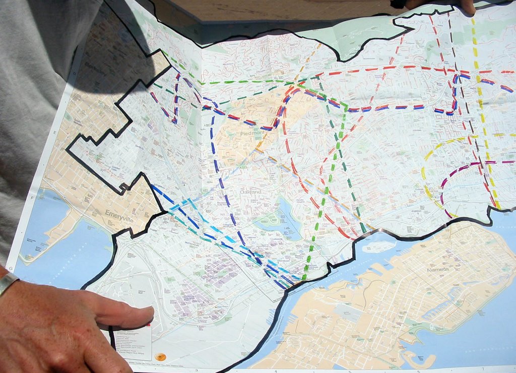
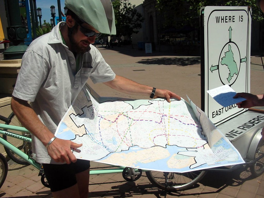
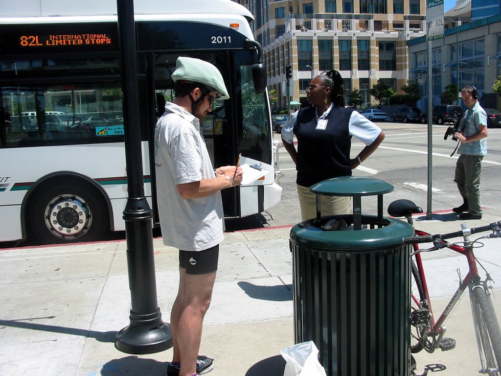
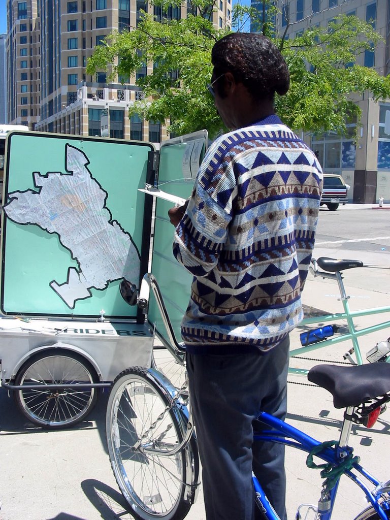
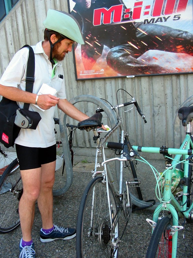
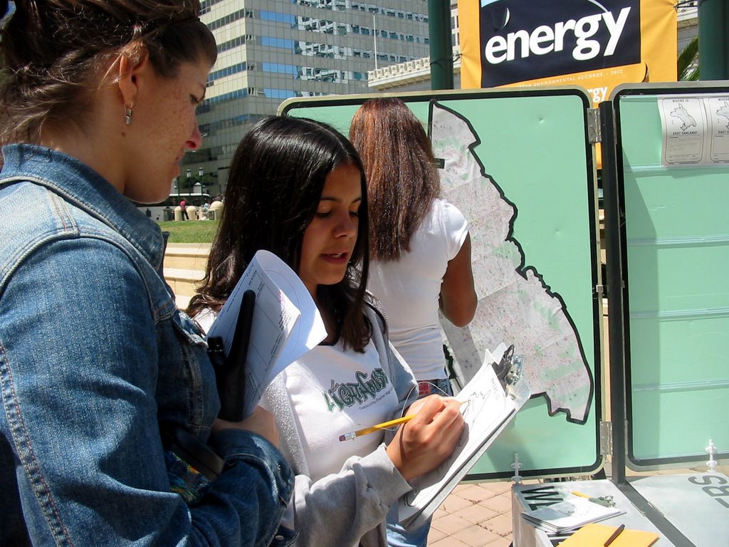
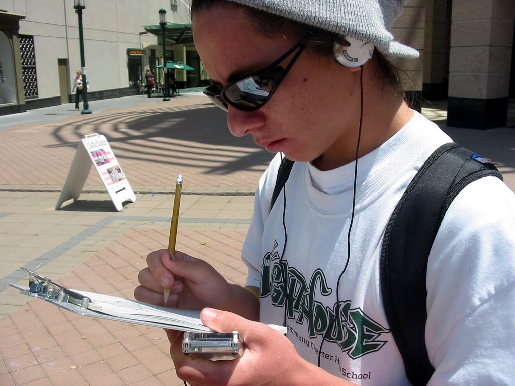
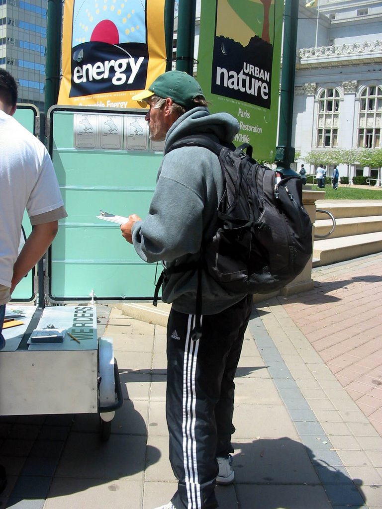
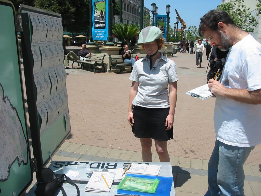
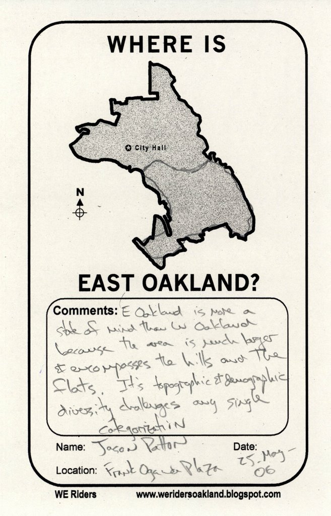
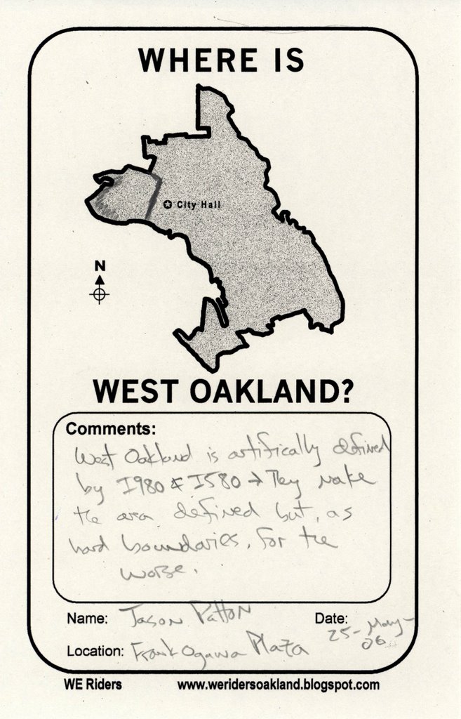
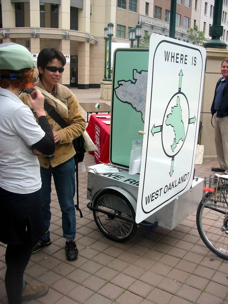
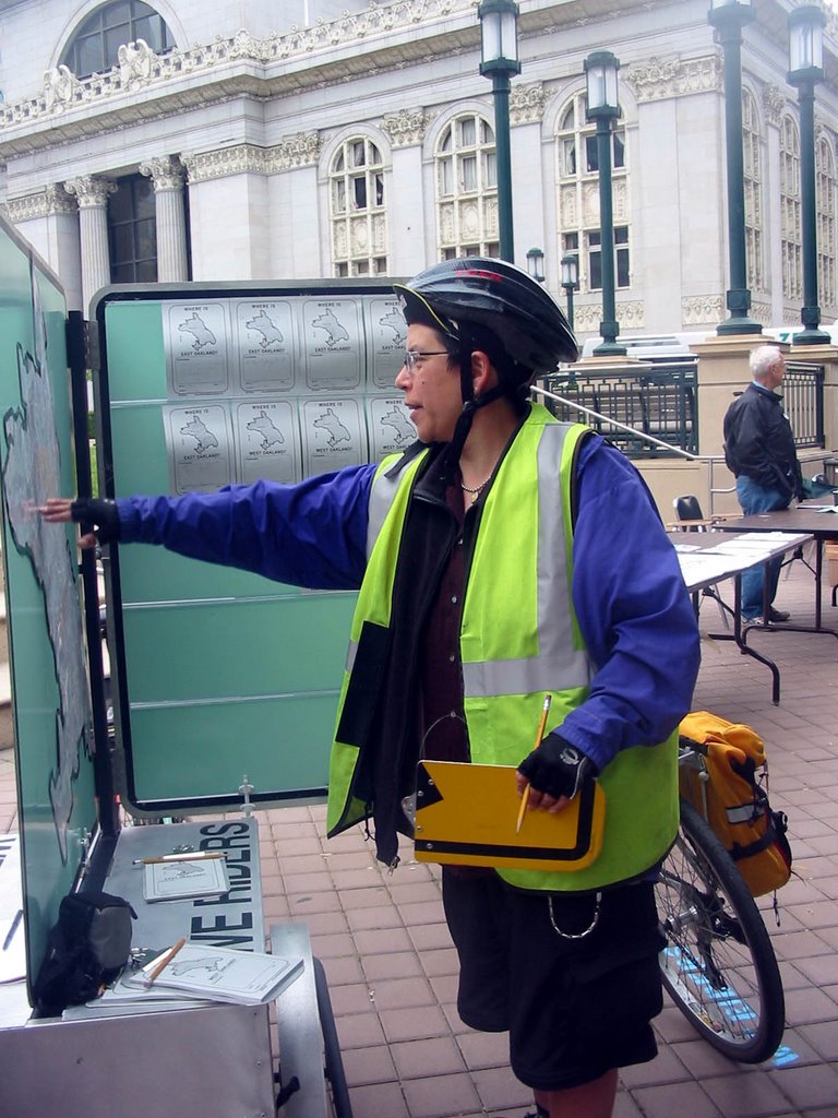
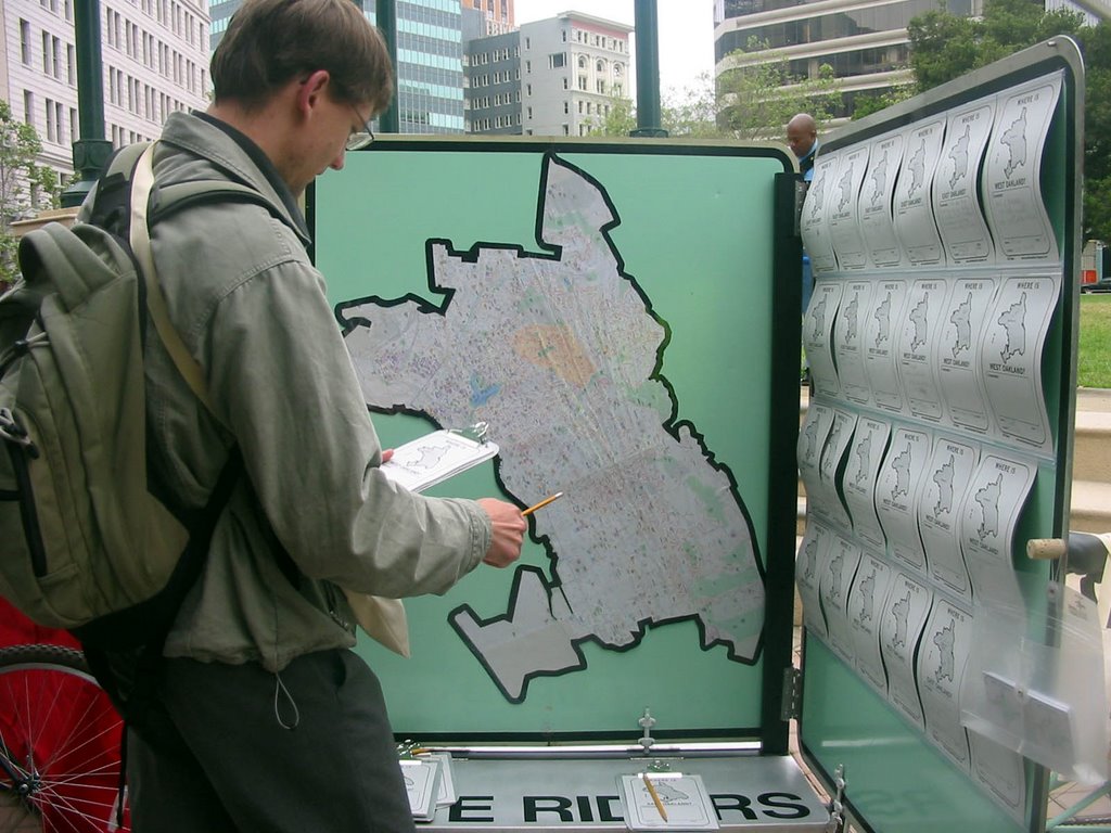
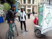
It didn’t take too long for BTWD attendees to realize that we weren’t like the other booths at the event. A few walked by with quiet curiosity. Soon, we were talking to loads of people who wanted to know what we were up to. As we explained the project, people were eager to help us with information concerning the whereabouts of West and East Oakland. By the end of the two-hour event, we had spoken with a diverse group of over forty people.Here are some of their comments:

'I'm a teacher at Fremont High School and I talk to my students about the all the time---we're actually in the south not the east because the bay runs southeast.'

'Where are West and East Oakland? Stay above the 580. Homicide is a big worry.'

'Thumbs up to ecotourism!!'

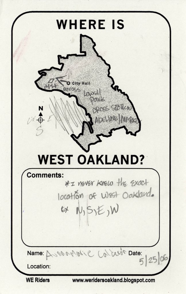
'I really have no idea---is there a there there?'

'You know you are in East Oakland when the street names change---You know, to First Ave and so on.'


‘Are you going to change the neighborhood names?’

Q: ‘Do you want to give your opinion about where West and East Oakland are?’

A: ‘No, I live there—I’m cool.’

‘They never put the neighborhood names on the map. And if they do, they’re wrong.’

‘West Oakland is easy: that’s where the West Oakland BART station is.’

'People identify with their neighborhoods, but above the 580, people don't say they live in East Oakland.'


'I'm scared to say! I have a terrible sense of direction.'

‘Do you have maps that show where West and East Oakland are?’

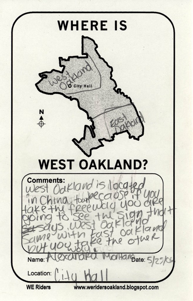
‘Good question---people are always talking about different places when they say West Oakland or East Oakland.’