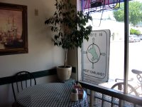
After a short walk around, we stopped at the Bay Café for a bite to eat. The café was crowded and air-conditioned; both were good signs. We parked our rig right by the front window where we sat; it was fun to see people slow down and read our sign, think a minute and then walk on. We wondered what stories they would tell about their experience.
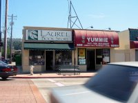
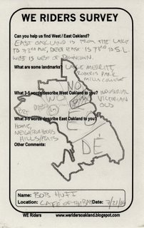
Just as we were finishing up our lunch (very hearty home-style sandwiches, served with pickles and chips), a guy stopped at our table wanting to know what our project was all about. He told us that he has been seeing us ride around Oakland these past weeks, but has never been in a spot where he could talk to us. He described East Oakland as “home, neighborhoods, hills/flats”. His map was very detailed, differentiating between East Oakland and Deep East. Lake Merritt is a small island in the middle of the city between West and East Oakland. He appreciated the project and was happy to participate; he felt that it is important for people to pay attention to the shape of the city. We asked him about the name of this neighborhood: do people call it the Laurel, Laurel District, or simply Laurel? We had seen all three versions of the name on various street facades. He told us, “Most people call it ‘the Laurel’”.
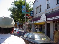
We talked to a few more people as we were getting ready to leave the Laurel. In response to our question, as to whether we were in East Oakland, one woman told us, “This is definitely East Oakland, honey, because my car insurance let’s me know!”





0 Comments:
Post a Comment
<< Home